Savad Kooh


Overview
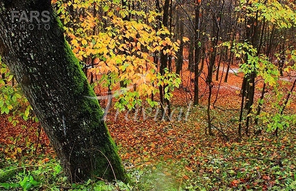
Savadkuh County is a county in Mazandaran Province in Iran. The county is subdivided into two districts: The Central District Shirgah District The county has a few cities: Zirab Shirgah Alasht Pol-e Sefid Covering an area of 2,441 square kilometres (942 sq mi), Savad Kooh is at the center of Mazandaran Province. It is limited northward by Qaemshahr, westward by Babol, eastward by Sari, southward by the Alborz mountain range and Tehran, and southeast by Semnan province. The main part of this city is located in a valley, in the central Alborz region, where Talar river passes. The tallest summit of Savad Kooh, is Arfa- Kuh, with a height of 3,500 metres (11,500 ft). The most important rivers flowing in this city are Talar and Babol-rud, which originate from the Alborz mountain range standing southeast and southwest of Savad Kooh. These rivers irrigate the farmlands in Babol, Babolsar and Qaemshahr. Including two areas of mountain in the north and foothill in the south, the mountainous area has a temperate and humid climate, and the weather in the south is dry and cold. The most important natural attractions of Savad kuh are: Shur Mast lake, near a village by the same name, Gazu waterfall in Lafur hamlet, waterfalls of Shirgah and Gaduk, the mountains of Arfa Kuh, Sangar and Qadamgah, in Rassto Pei hamlet and Shervin mountain in Valu Pei hamlet; and Alasht city.
Savad Kooh on Map
See more in Savad Kooh
Savad Kooh Hotels
Your Travel Journey Starts Here
Sign up and we'll send the best deals to you